


RM Products
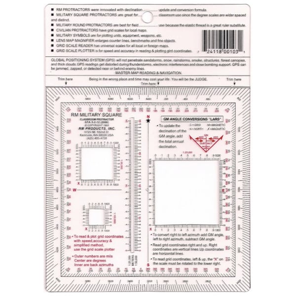
Military Square Protractor
Military Square Protractor
SKU:28007
Out of stock
Couldn't load pickup availability

Military Square Protractor
Essential Land Navigation Tool for GPS-Free Operations
The RM Military Square Protractor serves as your primary backup navigation tool when GPS systems fail or become unreliable. This protractor includes printed formulas and alignment diagrams to convert map grid north to magnetic north, ensuring accurate coordinate readings in the field. Built for military and tactical applications where precise navigation can mean mission success.
Key Features
- Grid-to-Magnetic Conversion Formula: Printed reference eliminates guesswork when aligning map coordinates with compass readings
- Alignment Diagram: Visual guide ensures proper orientation between map grid north and magnetic north
- Square Design: Provides multiple measurement angles and reference points for complex navigation tasks
- Field-Ready Construction: Designed to withstand harsh conditions where electronic navigation fails
- Compact Profile: Fits in map cases and cargo pockets for easy carry
When GPS Fails
Electronic navigation systems fail during sandstorms, heavy weather, electronic interference, and in dense forest canopies. GPS signals become unreliable near structures, during thunderstorms, and in tactical situations involving electronic countermeasures. This protractor provides the backup navigation capability needed when technology cannot be trusted.
Frequently Asked Questions
Why do I need the conversion formula printed on the protractor?
Map grid north and magnetic north rarely align. Without the conversion formula, your coordinate readings will be off target. This protractor includes the mathematical reference needed for accurate position plotting.
What makes this different from a standard protractor?
Standard protractors lack the military-specific conversion formulas and alignment diagrams needed for tactical land navigation. This protractor is designed specifically for military map reading and coordinate plotting.
Can this be used with any military map?
Yes, this protractor works with standard military topographic maps and includes the universal conversion formulas needed for accurate coordinate determination across different map series.